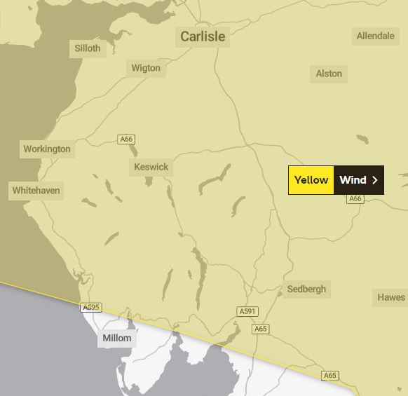
Up to 80mph gusts are predicted as Storm Malik comes to Cumbria.
A Met Office yellow weather warning – the lowest of three warnings issued by the forecaster – will come into force at 4am tomorrow and will run until 3pm.
A second yellow weather warning for wind has also been issued from 6pm on Sunday until noon on Monday.
What does the first warning say?
Strong westerly winds will bring some disruption on Saturday to Scotland, parts of Northern Ireland and northern England. This warning will cover most of Cumbria with the exception of parts of South Cumbria.
What to expect
- Some delays to road, rail, air and ferry transport are likely
- Probably some bus and train services affected, with some journeys taking longer
- Delays for high-sided vehicles on exposed routes and bridges likely
- Some short term loss of power and other services is possible
- It’s likely that some coastal routes, sea fronts and coastal communities will be affected by spray and/or large waves
“An area of strong winds will cross Scotland, parts of Northern Ireland and some northern counties of England on Saturday morning before easing during the afternoon. Gusts of widely 50-60 mph are expected and there is a chance of a brief period of gusts in excess of 70 mph in places, particularly for parts of eastern Scotland later in the morning.”
What does the second warning say?
Strong winds will likely cause some travel disruption and generate some large and dangerous waves around the coasts.
What to expect
- Road, rail, air and ferry services may be affected, with longer journey times and cancellations possible
- Some roads and bridges may close
- Power cuts may occur, with the potential to affect other services, such as mobile phone coverage
- Injuries and danger to life could occur from large waves and beach material being thrown onto susceptible sea fronts, coastal roads and properties
“On Sunday evening a spell of strong northwesterly winds is likely to develop across western Scotland, and then progress southeastwards eventually easing away from the North Sea coastlines during Monday morning.
“The strongest wind gusts will mostly occur around the coastlines and over the hills, with many of these exposed locations expected to see gusts reach 50-60mph for a time. In addition, a small chance that a very limited part of the area could see a short period of more damaging gusts, that could reach 60-70mph inland, and 70-80mph around exposed coasts and hills.”


